Tuesday, April 26, 2016

KEEPING the FAITH

Bonaire


       In the islands, one is constantly immersed in all things beautiful and natural and cannot help being ever mindful of God's almighty power and loving grace.  We are grateful daily for His mercy and protection as we wander these waters.  So whenever it is possible, we seek out a Catholic Church to in which to participate in Sunday Mass.  In fact, one of our main objectives when going ashore in some place new is to ascertain that specific information.  And then we note it in our worn guidebooks in case we ever pass that way again. 
  
 Deshaies (2)       Discovery Bay, JAM
          In the states, most Sunday Masses are forty-five minutes to an hour in length unless it is a special holy day or sacramental celebration.  We've found that to also be true for masses in the USVI.  The masses in the Spanish and French speaking islands tend to follow suit as far as their length. However, the mass is said in the native tongue and we understand very little Spanish and French and speak even less.  Ah, then there are the masses in the British Islands that are said in a language to which we can relate- all be it, the Queen's English.  Those are the masses that really "rock" and customarily last about two hours.
P4280110
          My most favorite Sunday Mass is celebrated weekly at 8 AM at St. John’s Catholic Church in the British West Indian Island of Portsmouth, Dominica.  This parish is a short, quiet walk (when no Saturday night rowdies are left on the street) from Prince Rupert Bay where we anchor our boat.  Indeed, the pastor knows well how to lead his flock because St. John’s currently has a building project underway that looks like it’ll more than double their worship space. Father Herman is an island boy and he delivers his sermons with enthusiasm and a sprinkling of local humor.  He is quite an articulate shepherd and invites- no, DEMANDS participation. Every now and then he’ll pause and say, “Amen, Church?” And if the parishioners don’t heartily respond he’s quick with the retort, “I can’t hear you, Church!”  Fr. Herman has also modified the mass to include an extra half hour or so of worship and prayers before he begins his half  hour plus homily and this suits savage soul well.
Gosier, Guadeloupe             2013-05-12 09.31.41
          On some occasions we find ourselves anchored in remote locations where there is no Catholic congregation.  That is when I rely on our on board Bible to at least spend part of Sunday morning reviewing the Readings for that weekend.  The website http://wordtoworship.com/lectionary/catholic has been a good resource for that.  Also, recently I  found and tapped into the convenience of having the daily readings posted to my email box by using http://usccb.org.    
Mayreau          DSCN4596
            Currently, on our way out of the Bahamas and island hopping toward the Turks and Caicos, we stopped in Clarence Town, Long Island where we planned to attend mass at Sts. Peter and Paul Catholic Church.  On Saturday evening we walked by the church and noted that the Sunday Mass time was posted as 9AM, followed by “TAITS”.  We wondered what TAITS meant and if Hurricane Joachim had a hand in whatever it was.  Down the next road, we stopped to inquire about it with a man on his front porch.  He didn’t know the answer, so he sent us two houses up the road to where the Catholic Catechist lived.  There we were disappointed to learn that, since Joachim, services were being rotated weekly to various congregations.  Mass would not be held in Clarence Town this weekend.  It would be held in a town farther south called TAITS.
      Ah, the best laid plans…
                   DSCN0835
    

Friday, April 22, 2016

RUM CAY

  DSCN4616       
        With a name like RUM CAY, how could we not visit this small island located in the Central Bahamas?  It is  mostly surrounded by reefs and was originally named Santa Maria de la Concepcion by Columbus.  Later it became known as Rum Cay after a ship wrecked on a reef and many bottles of its rum cargo washed ashore.  We searched the beaches at great length and must report that no rum is left to find. 
     DSCN4625          In fact, over the years, there has been little to find on this relatively small piece of paradise except more friendly Bahamians and a healthy dose of solemnity.  But Hurricane Joachim hit last November and now there is even less to find on Rum Cay.  Much damage was incurred and, although there is an inordinate amount of huge heavy duty earth moving rigs, not much looks to have been repaired.  USAid tarps still flap upon rooftops while other buildings have been reduced to rubble (left photo below).  Many of the few coconut palms here have either had their top lobbed off or are now growing almost parallel to the ground.  Joachim even blew the top planking off of the sturdily constructed goverment dock (right photo below).  
 DSCN4613       DSCN4606

 DSCN4602       
      
       Years ago, in an effort to control the erosion of beaches along the coasts of many Bahamian Islands, casuarina trees (from the fir family) were planted.  When we were in Georgetown, Exuma, we learned that these trees are currently considered an invasive species.  Casuarinas readily reseed and their roots grow very shallow, so when high winds and surf hit the beach, they tend to fall over, die, and need to be removed.  Joachim toppled many casuarinas on Rum Cay.
 
DSCN4605         One of the highlights of our stay in the bay at Rum Cay was most certainly the afternoon we spent with cruising friends Mike, Kimberly, and Ally of sv ALLY CAT.  We invited them on board Exit Strategy to play a round of games.  It began with playing a few hands of Mexican Train Dominoes and then they taught us how to play Chicken Feet Dominoes (photo below).  The crew of Ally Cat also brought an Apples to Apples card game and we enjoyed that, too.  And we heartily say “THANK YOU!” again to Ally for sharing a freshly baked loaf of Oatmeal Cinnamon Bread with us.
DSCN4629


Wednesday, April 20, 2016

The “Skinny” on LONG ISLAND

DSCN4587
         We eyeballed our way through scattered coral heads and anchored off of a long, lovely stretch of soft buff-colored sand in CALABASH BAY, LONG ISLAND.  As many of our stops have been, this was another recommended area to suit our deep keeled-boat.  The Santa Maria Beach Resort is located there and, thank goodness, was classy enough to not host all sorts of daytrip venues.  Two or three cruising vessels came and went almost daily, but the bay is so expansive that it still offered much privacy and ultimate relaxation.
      DSCN4590  
        Long Island is another narrow ribbon of land that is approximately eighty miles long.  Like all islands here, it lacks much elevation, but you can usually see both the east and west coasts from a ridge.  So after walking the local dirt roads to view what little there was in the vicinity, we rented a car for a day to undertake a self-guided tour.  As soon as our rental hit the dirt road, it began to rattle loudly, sounding like something was going to fall off its bottom.  We pressed on toward The Columbus Monument, our first stop, which took us along a rough path through thick brush that often scraped the side of the car.  We had to drive so slowly that we may have gotten there faster if we had walked.  Once there, though, the views from the rugged northern coast of Long Island made it well worth it.
DSCN4582
The Columbus Monument
     
DSCN4595
Sweet corn grown near house to conserve water.
                                                   Long Island has been experiencing a drought this season and as we drove southward (now on paved roads)the ill effects were readily apparent.  Much of the landscape was withered and any garden areas looked rather bleak.  We kept looking for fresh produce stands mentioned by cruisers, but found none.  In addition to the lack of sufficient rainfall, the island also was hit badly by Hurricane Joachim last November and much of the destruction remains in place.  We noticed many roof repairs underway as we proceeded.  At the gas station in SALT POND, a local told us that Joachim loomed over them for thirty-six hours and when they thought the hurricane was leaving, it swung back over the island again.  The force was so powerful that it lifted a large fiberglass resort pool out of the ground and deposited it about one-quarter of a mile down the coast.  It is no doubt that Joachim will long be remembered.
DSCN4596
Sts. Peter & Paul's Church built by Fr. Jerome.
          Finding an ATM was not easy on Long Island as we learned the the nearest one to our anchorage had been closed during the past year.  So we drove on through countless small settlements with the car now occasionally squeaking loudly.  CLARENCETOWN was to be our southernmost stop because we wished to check out the anchorage for future use and for provisioning there.  The folks at the marina informed us that Joachim blew away the groceries and a number of other businesses, so after a tasty lunch, we began our return drive northward.
DSCN4599
         
             DEAN’S BLUE HOLE, the world’s deepest blue hole at 406 feet below sea level, is on the island’s eastern coast just north of Clarencetown. We spent time there swimming, walking the seldom visited beach, and climbing the rocky remote coast. The annual Free Dive Competition is held in late May and the platforms seen in the photo (that I think detract from its beauty) are used for this event. 

DSCN4578
Cape Santa Maria Beach
           Being that there were no groceries to be had in Clarencetown, it was necessary for us to stop and shop in several different towns on our way back to Calabash Bay in order to find almost everything on our list.  The last grocery we found was in Salt Pond.  Had it been our first stop, it would have been our only stop as it had EVERYTHING and MORE!

Sunday, April 10, 2016

As Far NORTH As We’re Gonna Go

Google image
Google image
         If the Captain has his way, the latitude of 24°37.05’ N is as far north as Exit Strategy is ever going to go.  On a chart of the Bahamaian Islands, HALF MOON BAY, LITTLE SAN SALVADOR and ARTHURS TOWN, CAT ISLAND roughly lie at this latitude.
      
         We had read that Little San Salvador– just five miles long and surrounded by a maze of coral heads and reefs- was owned by Holland America and served as a cruise ship stop.  But we hadn’t seen a single ship since arriving in the Bahamas so we expected there’d be a lull in visitors at this small island.  We were very WRONG.  On our first day in Half Moon Bay, we were the only vessel in sight, but early the next day, and the next day, and… then Dan googled the cruise ship schedule.  Ships would be in the bay six out of seven days a week!  Again, we don’t begrudge anyone of the way they make their living, so we watched the bay bubble with activity between 9 am - 4:30 pm and were happy to be left alone each night.  One day we dinghied around the northwestern point of the island and enjoyed an untouched, long stretch of beach.   
small-collage_1[1]
Rake 'N Scrape music is quite lively and played using
 saws, drums, and a concertina accordian.
         Nevertheless, the next morning the winds were in our favor and we headed toward the northern part of Cat Island to Arthurs Town.  There we found ourselves alone in the bay day and night.  When we walked ashore the locals knew we were the people from “de boat” and were friendly and helpful.  Arthurs Town is a welcoming place where the people not only recommend a good place (in this case, the only place) to eat dinner, but also call someone to take you there at no charge.  We had a delicious mahi mahi dinner at De Smoke Pot Restaurant and when the owner learned that we had never heard Bahamian RAKE ‘N SCRAPE music, he rallied a few men to perform for us after dinner.  DSCN4545
          Cat Island, the birthplace of the actor Sidney Poitier, is about sixty miles long and not more that a mile wide at most points. So a few days later we moved southward along the coast to NEW BIGHT.  Once more, we stood out as “de people from de boat” for a couple of days until a few motor yachts stopped there to wait for better weather.  There were more businesses around New Bight, such as a place to get propane refills, fuel, and groceries, although we still had to let the ladies at the Blue Bird Restaurant know we were coming to make sure they’d have food.
          A main attraction at New Bight is Fr. Jerome’s Hermitage that he built on the highest peak of the entire Bahamas at 206 feet above sea level.  Fr. Jerome studied architecture before becoming a Jesuit priest and was sent to the Bahamas from England in 1908 to save souls and build churches that could better withstand hurricanes.  His churches, built for all denominations, have held up well and still grace many of the islands.
DSCN4556
Fr. Jerome's Hermitage
DSCN4568
Stations of the Cross
                 
      On our last evening in New Bight, we met and talked at length with a kindly old gent who filled us in on more Bahamian history.  The islands were first inhabited by the Lucayans which Columbus noted in his log of 1492 when he claimed the islands for Spain.  The Lucayan population dwindled quickly as they were exposed to diseases brought by the “white man“ (Spanish).  Then in 1648, the first English settlers came seeking religious freedom.  And finally in 1776,  a great  influx of Loyalists occured after England lost the War for Independence in the New World.  The inhabitants of today are either descendents of the Loyalists or “Fat Cats” from the USA and Europe.
DSCN4540                               We thoroughly enjoyed the beauty of Cat Island’s shores and its people.

Monday, April 4, 2016

EXUMA CAYS LAND & SEA PARK

 
       Exit Strategy entered the Exuma Cays Land and Sea Park (ECLSP) through WARDERICK CUT one sunny afternoon.  Mooring fields are situated at all the popular spots for exploration within the park, one being right at Warderick Cut. To use a mooring, one must contact the park via radio the day before you intend to arrive and be put on a waiting list.  Then the next morning at 9am the park assigns moorings via radio broadcast.  So if you are close enough to transmit and hear the daily park net, it is a simple, efficient system.  However, if you're not within VHF range, then you need to proceed to an approved anchorage. Prior to our arrival we were not within radio range, so we proceeded to one of the few places where anchoring is allowed, namely EMERALD ROCK.  The safe and suitable route  to Emerald Rock was yet another case of "you can't get there from here" easily due to a massive shoal area on the Exuma Bank.  By way of crow, the distance from Warderick Cut to Emerald Rock is about 1.5 nm, but the course we had to carefully motor was about 5 nm. 
 
                                       
       The ECLSP offers a collection of beautiful sites to snorkel, as well as many well-maintained trails to hike.  While we visited, the weather was more conducive to land activities, so we plodded through a number of trails on WARDERICK WELLS CAY and took in some beach time.   The Bahamas are coral atolls, so the trails oscillated from being soft sand to being hard, rough coral rock. Nothing substantial can grow on this type of terrain and finding a little shade ashore was a problem.  


       At the top of Boo Boo -as in GHOST- Hill. Boo Boo Hill on Warderick Wells Cay is so named because a ship wrecked near it off the Atlantic coast of the ECLSP.  It is said that you can still hear the cries of the crew at night if you are on the hilltop.   (Note the boats in mooring field over my shoulder.)
 
Vessel monument on ridge by Boo Boo Hill

       This impressive Humpback Whale skeleton is on beach near the ECLSP Office.  It was salvaged in the 1990's from Highbourn Cay- Exuma after the whale beached himself.  They believe the whale may have been confused by sonar signals being  emitted by a US Navy vessel who was conducting tests in the vicinity.
 
We hiked many trails since the current was too
 strong on many days to snorkel safely.
 
       On days when the weather was calmer and the current was not as strong, we snorkeled a couple of sites.  The area around Emerald Rock was disappointing at best.  Two dinghy moorings were available there, but after swimming over and around the first spot, we decided to skip the second. So far, we have been somewhat disenchanted by snorkeling in the Bahamas.  The coral heads strewn throughout the Exuma Bank waters are often small with a distance between.  Also,  swimming has been difficult because there often exits a forceful current.
 

Vivid corals in cut at Hog Cay.

One morning while hiking to the top of the ridge, we caught a glimpse of a completely empty and visually inviting mooring field (of 5) in the ECLSP by HOG CAY.  We were giddy with delight- if you can imagine that- and radioed the park office to make a reservation for the next day.  Spending the night there along the Atlantic coast would also serve us as a great jumping off point to sail to our next destination.  At 9am the next day we got our mooring assignment and began our 5 nm. trip out of the Emerald Rock anchorage.
        Upon entering the mooring area at Hog Cay we found one huge motor yacht on a mooring.  We carried on toward our assigned ball and saw another even larger motor yacht power towards OUR ASSIGNED MOORING and pick it up!  Words and a few hand signals were exchanged and then we took the next ball past them.  Danny radioed the park office who immediately sent two ranger boats to take charge of the matter.  What we didn't fully realize was that the ball we were assigned was the ONLY one on which we wouldn't go aground at MLW.  The yacht apologetically released our ball and we picked it up. 
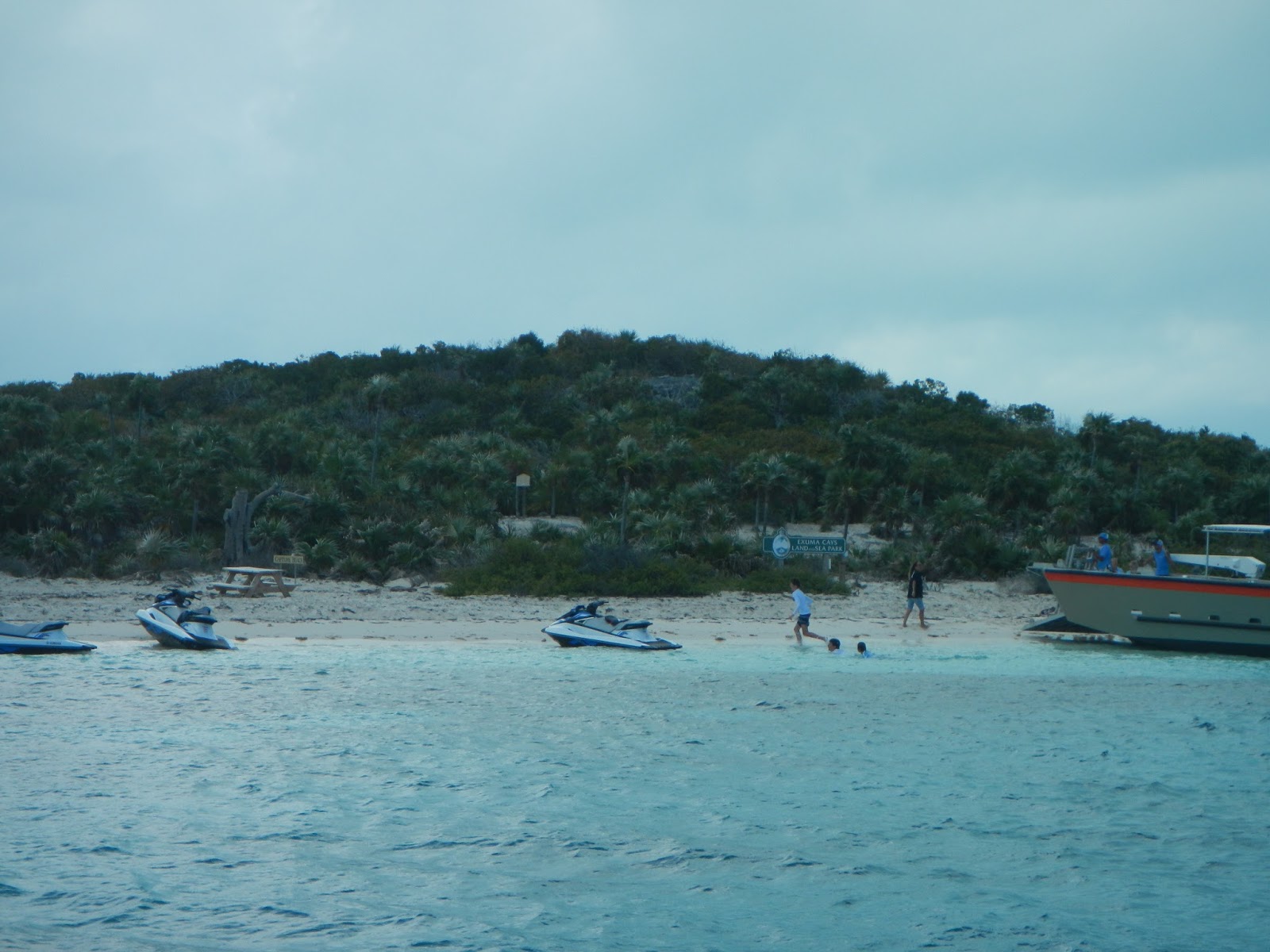
        Shortly afterward, another motor yacht- this one SUPERSIZED- picked up the mooring next to us.  Then the "circus" really began.  A 40' transport vessel pulled up to the shore and unloaded SUPs, kayaks, jet skis, umbrellas, coolers, etc...  There were about 20 guests, aged maybe 18-24, on the mega yacht perhaps doing Spring Break on Daddy's Gold Card.
         We were no longer giddy with delight.


Tuesday, March 29, 2016

Going with the Flow


On our way to BLACK POINT SETTLEMENT- GREAT GUANA CAY, the sailing conditions were finally amenable to troll for dinner.  I am always the first one to select a lure and put out the pole and this day was no different.  Exit Strategy was moving along quite comfortably with a speed that ranged between six to seven knots.  ZZZZINNNG!  We got a hit!  Although I was closest to the rod mounted on the portside rail, I insisted that Captain Dan reel in our catch.  I did this because I had been on a losing streak since arriving in the Bahamas in late February.  I can only surmise that the game are feistier up here because I'd been unable to land the last four out of four fish we hooked.  Danny gladly took the rod in his strong arms and kept the line taut, eventually hauling in a beautiful yellow fin tuna.
 
 
This yellow fin tuna weighed 15 lbs. after being gutted and bled.


Within a few hours, we maneuvered through DOTHAM CUT and dropped the hook at Black Point Settlement.  The wind howled almost constantly at 25 knots, gusting to 30 during our entire stay.  We went ashore a few times to amble along the worn roads and see what the island was like.  Black Point Settlement is the kind of place where it is not unusual to select your own chicken parts after the grocer gives you a twenty pound frozen mass of chicken legs to take outside, so you can drop it onto the cement and bag your selection.  It is the kind of place where the islanders give you free fruit from the few producing trees they have.  Black Point Settlement is the kind of place where everyone greets you warmly and then some- like the retired police chief- invite you into his home to hear about his career and view his medals. 

This was the first time we were able to see some examples of "pothole" gardening that we had previously read about in the guidebooks.  After that experience, we began to notice these potholes all over the place on every cay we visited.  There seemed to be a great deal of half finished or abandoned building sites down every path at Black Point. It concerned us when we often found these potholes (without a garden) smack in the middle of a building's foundation. How safe is that?! 
 
Pothole gardening

There really wasn't much to keep us at Black Point Settlement, so as soon as the weather improved we continued on to STANIEL CAY.  Does that name ring a bell for you?   Staniel Cay is known to tourists for its swimming PIGS, although the pigs are actually located on the nearby cay called BIG MAJORS SPOT.  It appears that  the pigs are one of the biggest attractions in this area of the Bahamas.  However, swimming pigs were NOT on our list of things to see.  In fact, Staniel Cay wasn't even on our float plan until the starter battery on Exit Strategy began to show signs of imminent death.  The folks in Black Point Settlement assured us that we could get a new battery quicker in Staniel Cay because there was a marina there. Lucky for us- they were right.

 
How many conch can YOU find?  (There are about 20 live ones in photo.)


Bahamian houses in the Exumas were colorful and usually 2-story.

 
Staniel Cay is ten times more touristy than Black Point Settlement largely due to the swimming pigs, the marina, and THUNDERBALL GROTTO.  The James Bond movie, THUNDERBALL, was partially filmed here in 1965 and literally put Staniel Cay on the map.  Since we were "in the neighborhood" we decided to take in the site one afternoon. We could see daytripper boats coming and going to the grotto from our anchorage and tried to time our sortie to avoid the crowd, but that didn't work.  We enjoyed a brief moment alone inside the grotto and then swam out through an alternate underwater tunnel when a large group entered the main opening.  A short time later, we swam back inside and noticed a lion fish, whose spines are highly toxic, slowly swimming beneath the finned feet of people.  That looked like an accident waiting to happen to us.


We had just swam out of a tunnel to escape the Thunderball Grotto tourists.


Coral wall at main entrance to the grotto.


LION FISH (bottom to left of center) a few feet below unknowing tourists!


Friday, March 25, 2016

SEARCHING for the ROAD LESS TRAVELED

The First (& Last) Mate is always on the lookout for coral heads and sandbars
 when entering an unfamiliar cut in the Bahamas
After two and a half weeks in the vicinity of Georgetown, Great Exuma, we had had enough of the cruiser crowds and the constant chatter on the VHF radio, so Exit Strategy headed northward along the chain. Our first stop was at CHILDREN'S BAY CAY, a small, privately owned island.  It was one of those places that you reach eventually after entering a cut (RAT CAY CUT) a few miles before it and then slowly work your vessel through channels that are just deep enough.  As I mentioned before, a major challenge here in the Bahamas has been the shallow depths for our 6'10' draft. The tide changes four times daily and the depth also varies with season. During this visit, the tide difference averages about three feet.  It took about forty minutes to get to Children's Bay Cay and then we anchored with about three and a half feet under our keel.

We anticipated a quiet few days here, but within a half hour a parade of daytripper powerboats began to whizz by us and then return in the opposite direction until nearly dusk.
Notice how the changing tides result in mushroom shaped rocks.  At high tide this is not apparent.
WINDSOCK CAY was a short distance to the west of where Exit Strategy was anchored.  The guidebooks reported, "There is good snorkeling and spearfishing around Windsock Cay." Intrigued by that description, we dinghied over one afternoon. There was a small warm beach there, but it was disappointing to find no obvious areas to snorkel or spearfish.  We considered snorkeling out a ways from the cay, but that would have put us in the path of the daytripper highway.

Windsock Cay looked nice, but was nothing like the guide described.

A couple of days later, we left Children's Bay Cay and retraced our path back out of the cut to resume our exploration of the Exumas.  ADDERLY CUT gave us access to our next recommended uncrowded spot at LEAF CAY.  Lee Stocking Island (different from STOCKING ISLAND near Georgetown) can also be accessed from this cut and was described as being "as popular a stop as Georgetown." So we carefully maneuvered away from Lee Stocking Island and worked our way around a huge shoal to anchor at Leaf Cay, "a peaceful spot near a perfect beach."

However, as we dropped anchor at Leaf Cay, the loud buzz of an engine approached and rattled Exit Strategy with its huge wake. The powerboat slowed and turned toward Leaf Cay just around the point.  We recognized the boat as one of the daytrippers that had inadvertently antagonized us in recent days.  Ah-HA!  Now we knew where they all were going!  

M-m-m- bet he'd make a fine stew!
The next day, we took a ride around the point and discovered that "perfect beach" for ourselves.  About a dozen iguanas lumbered to the shore to welcome us.  I could have caught one easily.  We observed later that the daytrippers bring veggie scraps for the iguanas, so they are quite used to humans. They are called "pink" iguanas because of their coloration.

As annoying as the tour boat traffic was, we could not leave the area without exploring NORMAN'S POND CAY, nor could we deny the tour operators their living.  Norman's Pond Cay was literally a stone's throw across the daytripper highway. Many years ago, it served as a salt producing center, but now only a few ruins are left.  We walked along the rugged western coast and found an exquisite tide pool that led to a cave.   

Our private pool on the Northwest coast of Normans Pond.
Although, our time on board Exit Strategy was sometimes exasperating due to the tour boats, our time off the vessel in these locations was invigorating and certainly memorable.

Sunset over Normand's Pond Cay.